Ancient Maps of India
Old Maps of India
Span of Vijayanagar Empire |  |
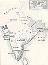
 | India Before Wellesley Map shows the areas controlled by East India Company at the turn of century |
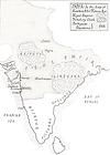
India in Early 17th Century Map of India at the time of Hawkins and Sir Thomas Roe |  |
 | Map of India in 1914 Map showing states protected by British. Circa 1914 |
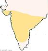
Span of Satavahana Empire Satavahana kings ruled much of Deccan plataeu between 50 B.C. to 250 A.D. |  |
![]()
See Also:
![]()

